
Keyword
Marine Features (Australia) | Port Phillip Bay, VIC
5 record(s)
Type of resources
Topics
Keywords
Contact for the resource
Provided by
Formats
Update frequencies
Status
draft
-
In 1991, CSIRO was approached to design and manage an environmental study of the Bay to seek answers to questions concerning the sustainable use and management of the Bay. The Study began in October 1992 and finished in June 1996. The Port Phillip Bay Environmental Study was managed by CSIRO and supervised by a Management Committee chaired by the (then) Department of Conservation and Natural Resources. Also represented on the committee were the EPA, Melbourne Water, Melbourne Parks and Waterways and the former Port of Melbourne Authority. The Study was totally funded by Melbourne Water and Melbourne Parks and Waterways. In all, some 47 research tasks were conducted, ranging from scientific literature reviews to fullscale field surveys. All were contracted out. Of the 30 contractors, six were Victorian State agencies, three Commonwealth agencies, nine universities and 12 consultants. Nineteen contractors were Victorian based, seven from interstate and four from overseas. The research programs covered the fields of physical oceanography, toxicants, algal nutrients, marine ecology and ecological modelling. A final report was delivered "PORT PHILLIP BAY ENVIRONMENTAL STUDY FINAL REPORT" :Harris, G., G. Batley, D. Fox, D. Hall, P. Jernakoff, R. Molloy, A. Murray, B. Newell, J. Parslow, G. Skyring and S. Walker. (1996). Port Phillip Bay Environmental Study Final Report. CSIRO, Canberra, Australia. Published on CD ROM by CSIRO Publishing, Melbourne, 1999.) 47 technical reports were also produced. In additition in April 2007 a data set collection was supplied to CMAR Data Centre by Dr John Parslow (CMAR) on CD ROM, and relates to the Port Phillip Bay Environmental Study conducted between 1992 and 1996. These datasets include: Bathymetric data, Coastline data, Data from current meters and coastal radar, Flow data for rivers, creeks and drains, Various meteorological data sets, Water salinity and temperature data, Data sets from various tide gauges and Sediment related data sets. The CD ROM also includes electronic copies of the Overview Report 39pp, Final report 248pp and the 47 Technical reports. 26, May 2015, Received Port Phillip Bay Environmental StudyData, GIS and Reports CD-ROM created by CSIRO Environmental Projects Office - robert.molloy@csiro.au (2003) from Lawrance Ferns Department of Environment, Land, Water & Planning (lawrance.ferns@delwp.vic.gov.au). Added to PortPhillipBayDATA_additonal netwrok archive and media items.
-
The O&A Marine Plankton Collection comprises of historical zooplankton samples collected between 1940 - 1996. The collection is housed at the EcoSciences Precinct, Dutton Park, QLD. The collection includes: (1) Phytoplankton and zooplankton samples collected by the Integrated Marine Observing System (IMOS) Australian Continuous Plankton Recorder survey (AusCPR) (2) Zooplankton samples from the IMOS National Reference Stations program. (3) Detailed information regarding the plankton collection held at Dutton Park was added in August 2014 (refer to: Plankton_Historic_samples_ sorted_ by_AF_24_06_2014.xlsx). Note that this list is incomplete and is currently only a working list, as such it be updated regularly. Refer to document link below. The collection includes data collected by the following vessels: 1. Diamantina voyages 1959-1963: Indian Ocean, Western Australia, GAB, Jjakarta, Sumatra, North West, during 1970-1973 (1973 Freemantle to Hobart). 2. Derwent Hunter 1954-1961: South East Australia (1959-60), NSW coast (Port Stephens-Jervis Bay) and Tasman Sea (1960), Jervis Bay 1961, 3. Courageous (1978) 4. Gascoyne: 1962, SE Indian Ocean Coastal Station Data: 1. Port Hacking stations: 1959, 1968-1971 2. Batemans Bay 1959-1960, 3. Bermagui 1957-1960 4. Jervis Bay 1958-1960 4. Eden NSW: 1956-1960
-
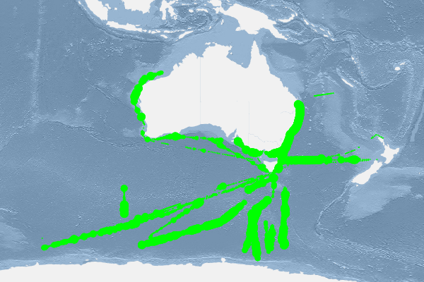
The Australian Continuous Plankton Recorder (AusCPR) survey is a joint project between CSIRO Oceans and Atmosphere (O&A) and the Australian Antarctic Division (AAD) to measure plankton communities as a guide to the health of Australia's oceans. The AusCPR survey is part of the Integrated Marine Observing System (IMOS), a national collaborative program to observe Australia's marine environments. IMOS is funded by the Commonwealth Department of Education, Science and Training. The aims of the AusCPR survey are to: * map plankton biodiversity and distribution * develop the first long-term plankton baseline for Australian waters * document plankton changes in response to climate change * provide indices for fisheries management * detect harmful algal blooms * validate satellite remote sensing * initialise and test ecosystem models. Servicing and maintenance of the CPRs and analysis of the samples for the AusCPR survey will be carried out by staff based at the O&A CSIRO laboratories in Brisbane (QLD), Hobart (TAS) and at the AAD in Hobart (TAS). The project is funded by the Integrated Marine Observing System (IMOS) and falls with the Ships of Opportunity facility. Data storage and access is planned to be interoperable with other national and international programs through the IMOS Infrastructure. Results from the AusCPR survey are available through the AODN portal: https://portal.aodn.org.au.
-
These data are IMOS AusCPR datasets comprising combined phytoplankton and zooplankton records, which are supplied to the Global Alliance of Continuous Plankton Recorder Surveys (GACs - http://www.globalcpr.org ). See: IMOS - AusCPR: Phytoplankton Abundance http://www.marlin.csiro.au/geonetwork/srv/eng/search#!c1344979-f701-0916-e044-00144f7bc0f4 IMOS - AusCPR: Zooplankton Abundance http://www.marlin.csiro.au/geonetwork/srv/eng/search#!c1344e70-480e-0993-e044-00144f7bc0f4 These data consist of the combined Phytoplankton and Zooplankton data, and are distributed to the Global Alliance of Continuous Plankton Recorder Surveys (GACs - http://www.globalcpr.org). Data are distributed using the Global Biodiversity Information Facility (GBIF) Integrated Publishing Toolkit (IPT), and are comprised of three related datasets: Metadata: AusCPR_METADATA Event Data: AusCPR_EVENTDATA Occurrence Data: AusCPR_OCCURRENCEDATA ---- Context: Phytoplankton and Zooplankton abundance records: The Australian Continuous Plankton Recorder (AusCPR) survey is a joint project between CSIRO Oceans and Atmosphere (O&A) and the Australian Antarctic Division (AAD) to measure plankton communities as a guide to the health of Australia's oceans. Details on how phytoplankton and zooplankton abundance data were analysed are described in the metadata links above. It is advised that anyone using the data should first read this methodology or contact the project contact person. The aims of the AusCPR survey are to: * map plankton biodiversity and distribution * develop the first long-term plankton baseline for Australian waters * document plankton changes in response to climate change * provide indices for fisheries management * detect harmful algal blooms * validate satellite remote sensing * initialise and test ecosystem models. Servicing and maintenance of the CPRs and analysis of the samples for the AusCPR survey will be carried out by staff based at the CSIRO O&A laboratories in Queensland and Tasmania, and at the AAD in Hobart. The project was funded by the Integrated Marine Observing System (IMOS) and falls with the Ships of Opportunity facility. Data storage and access is planned to be interoperable with other national and international programs through the IMOS Infrastructure. Results from the AusCPR survey are available through the AODN portal: https://portal.aodn.org.au. For information on using the data please refer to the Richardson et al. 2006. As the taxonomic resolution of the data has changed over time, due to continual training, it is important that users refer to the change log tables included in your data download. These will provide information on the validity of the taxa, from what date we have been identifying certain taxa etc. Classification fields may be blank depending on the level to which that taxa has been identified, i.e. if only identified to family, genus and species will be blank. This data is freely available but please acknowledge all relevant parties, as detailed in acknowledgement section.
-
AusCPR: Phytoplankton Abundance. The Australian Continuous Plankton Recorder (AusCPR) survey is a joint project between CSIRO Oceans and Atmosphere (O&A) and the Australian Antarctic Division (AAD) to measure plankton communities as a guide to the health of Australia's oceans. The phytoplankton abundance data are analysed as per Richardson et al 2006. Phytoplankton are usually counted from water samples after settling but in the CPR analysis we count the phytoplankton in situ. With CPR samples, the phytoplankton is captured by the mesh and are caught by the silk strands, by phytoplankton mucilage, and/or by other organisms on the silk. It is thus possible to see the phytoplankton cells directly on the mesh. In essence, the phytoplankton is already concentrated. Washing the phytoplankton off the silks to count in the standard manner may result in loss of or damage to cells before analysis. It is advised that anyone using the data should first read this methodology or contact the project contact person. The aims of the AusCPR survey are to: * map plankton biodiversity and distribution * develop the first long-term plankton baseline for Australian waters * document plankton changes in response to climate change * provide indices for fisheries management * detect harmful algal blooms * validate satellite remote sensing * initialise and test ecosystem models. Servicing and maintenance of the CPRs and analysis of the samples for the AusCPR survey will be carried out by staff based at the O&A laboratories in Queensland and at the AAD in Hobart. The project was funded by the Integrated Marine Observing System (IMOS) and falls with the Ships of Opportunity facility. Data storage and access is planned to be interoperable with other national and international programs through the IMOS Infrastructure. Results from the AusCPR survey are available through the AODN portal: https://portal.aodn.org.au. For information on using the data please refer to the Richardson et al. 2006. As the taxonomic resolution of the data has changed over time, due to continual training, it is important that users refer to the change log tables included in your data download. These will provide information on the validity of the taxa, from what date we have been identifying certain taxa etc. Classification fields may be blank depending on the level to which that taxa has been identified, i.e. if only identified to family, genus and species will be blank. This data is freely available but please acknowledge all relevant parties, as detailed in acknowledgement section.